Public Access Enhancement
The CNMI Constitution protects public access to the sea and tidal areas as a matter of cultural heritage. As the coastal zone management program of the CNMI, DCRM is committed to maintaining and enhancing public access to these coastal areas in the face of increased use, commercial and industrial development, sea level rise, natural disasters, and other stressors.
The Shoreline Access Guide (2015) provides information about the recreational opportunities and amenities found at access points across Saipan, Tinian, and Rota.
UPDATEd SHORELINE ACCESS GUIDE – Ongoing
Project Description: Over the past two years, DCRM has been evaluating the condition of public shoreline access sites on Saipan, Tinian, and Rota. They plan to release an updated version of the Shoreline Access Guide (2015) in 2025. This updated virtual guidebook and story map will offer details on the current amenities and facilities, taking into account improvements and damages caused by Super Typhoon Yutu and Super Typhoon Soudelor. Additionally, it will highlight the historical and cultural significance of each site.
This project works towards DCRM’s Strategic Plan Goal 1: “Public access and use of coastal resources are enhanced, protected, and restored.”
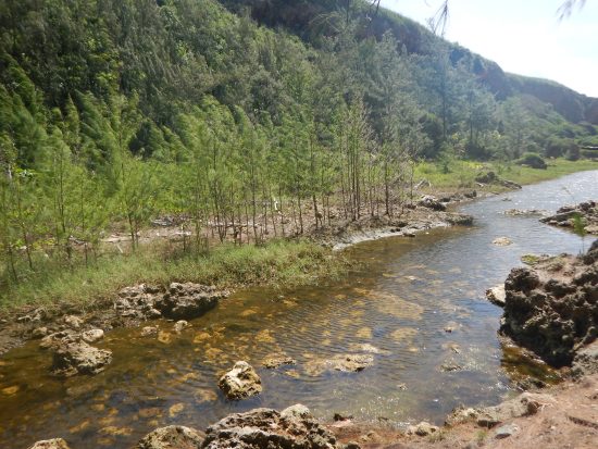
Jeffrey’s Beach habitat restoration and public access enhancement project – ongoing
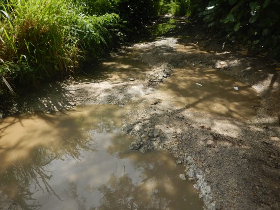
Project Description:
Jeffrey’s Beach, nestled on the eastern shores of Saipan, serves as a vibrant meeting point for the Talofofo stream and the ocean. Recognized as Saipan’s most significant estuary, this site provides essential access to a rich tapestry of native plants and animals. Following the 2018 Saipan Shoreline Access & Shoreline Enhancement Assessment (SASEA), the Division of Coastal Resources Management (DCRM) pinpointed the need for enhancements at Jeffrey’s Beach. The area’s deteriorating road posed not only a safety risk but also contributed to sedimentation issues. The Office of Insular Affairs (OIA) under the Inflation Reduction Act (IRA) granted the DCRM over $900,000 for the Jeffrey’s Beach Habitat Restoration and Public Access Enhancement Project. This project will construct an elevated boardwalk complete with educational signage and a permeable parking lot, replacing the existing worn path. This development aims to safeguard coastal ecosystems while fostering passive public engagement and sustainable tourism.
In a move to protect the environment, the project will limit vehicle access, addressing erosion and its impact on the water quality of the adjacent estuary. The boardwalk’s design focuses on minimal environmental intrusion, enhancing access to the beach and safeguarding the wildlife habitat. It aims to connect the dots between the different ecosystems, from the intermittent stream/estuary, classified as a wetland, to the beach/shoreline, encouraging visitors to immerse themselves in the natural and cultural significance of the locale.
Spanning approximately 400 meters (1,312 feet) and starting near the current trailhead at Route 36, the boardwalk will follow the path of the existing road, culminating at Jeffrey’s Beach. At 1.5 meters (5 feet) wide, it will feature a parking space of 186 square meters (2,000 square feet), educational signs, and a viewing platform at its end. The entire project covers roughly 786 square meters (0.2 acres), with the boardwalk and parking area occupying 600 square meters (0.14 acres) and 186 square meters (0.045 acres), respectively.
This project brings together environmental conservation and public access for users. It opens up opportunities for ecotourism, including birdwatching and sightseeing. The boardwalk aims to be a testament to the beauty and ecological importance of the CNMI’s forests, aiding in vegetation recovery and reducing sediment runoff, with a hopeful completion by 2027.
This project works towards DCRM’s Strategic Plan Goal 1: “Public access and use of coastal resources are enhanced, protected, and restored.”
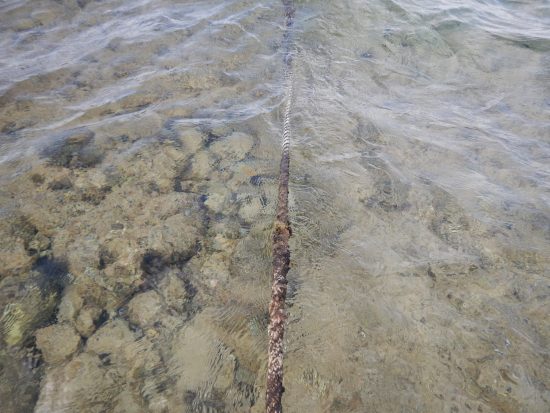
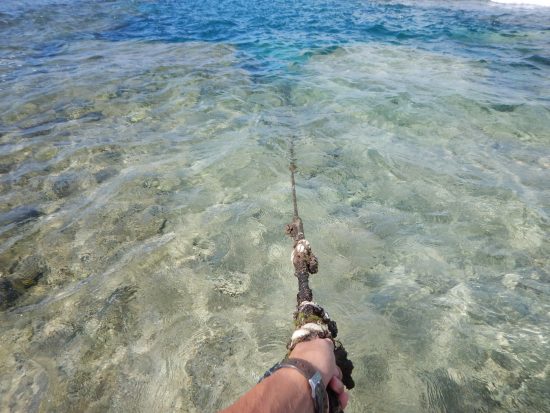
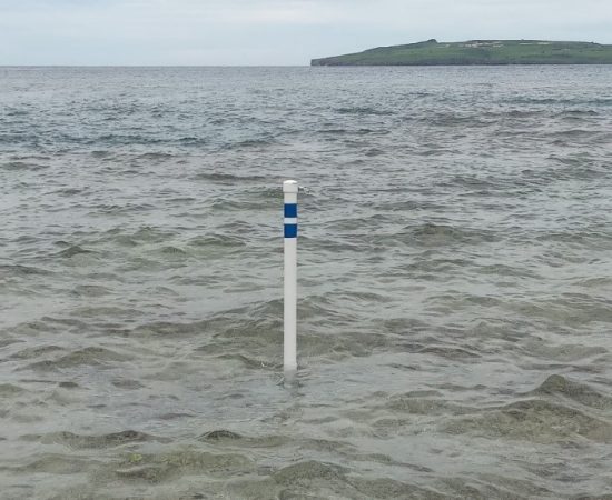
Lao Lao Bay Diver’s Path – completed
Project Description: Lao Lao Bay has long been one of the more popular dive sites on the island of Saipan for residents and tourists alike. Before tourism was impacted by the COVID-19 pandemic, hundreds of visitors would go to the site each day. It is likely that the number of visitors will increase when tourism resumes based on historical tourism trends in the CNMI. The 2015 DCRM Public Access Guide for Saipan, Tinian, and Rota identified several channels that divers utilize to enter the deeper expanses of the bay. To the inexperienced diver or tourist unfamiliar with the area, these channels may be difficult to identify and footing can be hazardous due to incoming waves. Without visual aids, divers follow local tour operators who are knowledgeable about these paths and utilize ropes that have been installed at drop-off points to enter the deeper areas.
To address this issue, in July 2022, DCRM contracted the professional services of Tasi Research & Consulting (TRC) to carry out the installation of the dive markers and information signage. The dive markers provide experienced and inexperienced divers alike, with the visual aids needed to guide them to the dive spots. Moreover, the purpose of this project is to alleviate stress on the adjacent coral reef environments and narrow the footprint of divers, residents, and visitors. For the terrestrial component, TRC had received input from various divers on Saipan about the initial concept for the associated signage for the dive markers. TRC had worked with DCRM Outreach Coordinators on the design and development of the signage, which will be installed onto a preexisting frame at the Lao Lao Bay dive site.
This project works towards DCRM’s Strategic Plan Goal 1: “Public access and use of coastal resources are enhanced, protected, and restored.”